Sunday, May 25, 2008

May 21st - Skagway to William Henry Bay

We departed Skagway under glorious blue skies. As we looked back up Lynn Canal (Channel) we could see the northern end of the Inside Passage. We reached our north most point:
LAT: 59 deg 26' 9"
LON: 135 deg 19' 3"
According to Wikipedia: "The Alaskan portion of the Inside Passage, in the north, extends 500 miles from north to south and 100 miles from east to west. The area encompasses 1,000 islands, 15,000 miles of shoreline and thousands of coves and bays. British Columbia's southern portion of the route is of similar extent, with up to 25,000 miles of coastline, and includes the narrow, protected Strait of Georgia between Vancouver Island and the B.C. mainland, the Johnstone and Queen Charlotte Strait between Vancouver Island and the mainland, as well as the wider and more exposed Hecate Strait near the Queen Charlotte Islands.


We anchored at William Henry Bay in a depth of 62 ft. near the mouth of a small glacial river. The water was like glass. Other than the 18ft. tide rising and falling we barely moved during the night.

It was the crab's lucky day as Lou released him unharmed.

Ann and I explored the bay in "Wings". There were 2 waterfalls and the rugged coastline was encrusted with mussels.
In the morning we headed for Auke Bay. Louie played a tune on the fog horn.
Ann and Howard will return home the next day. They will be greatly missed!

Friday, May 23, 2008

May 18th - Haines to Skagway

Skagway is filled with history of the Klondike gold rush and home to the "White Pass and Yukon" train route. Cruise ships frequent this stop at the end of the inside passage


The town is filled with clever tourist shops.

We met this prospector by the name of "Lou". He was sitting on the stairs in front of the building built in 1899 covered with driftwood in a mosaic pattern. He has seen the "Stampeders" with Klondike fever pass by. He has seen the greed and lust for gold. He has seen the pathos of the Chilkoot and White Pass Trail.
OOPS! wrong Lou, it is our Louie. FURGITABOUT IT!

May 19th - White Pass & Yukon Route Train


"HERE COMES ENGINE #69 !
The steam train runs on Saturdays and Sundays up the White Pass Trail.

In 1897 word of the Klondike Gold Rush hit Seattle. The Post-Intelligencer reported that 2 tons of gold had been unloaded from the "Portland" which had arrived from the north and thus started one of the most infamous journeys in history. Over 100,00 "Stampeders" rushed to the Yukon only about 40,000 completed the journey. There have been approximately 12.5 million ounces taken from the Klondike since the discovery.


"The inhumanity which this trail has been witness to, the heart break and suffering which so many have undergone cannot be imagined. They certainly cannot be described."
~ Clifford Stifton, Canadian Minister of the Interior, 1897.


This is the 26 mile Chillkoot Trail. In the winter, Stampeders struggled in blizzards, snow, frigid temperatures, and avalanches. The trail shot up about 1,000 feet in the final half mile. Stampeders climbed the "golden staircase," 1,500 steps cut in the snow and ice, and used a guide rope for support. Circa 1898.

Conditions on the White Pass trail were dreadful. The route was narrow, steep, slick and overcrowded. Nearly 3,000 pack animals died. Drivers rushing over the pass had little concern for beasts. Exhausted horses starved, were hurt on rough ground, became mired in mud and fell over cliffs. Novelist Jack London, a witness, renamed White Pass the "Dead Horse Trail." Circa 1897.


Construction started on the White Pass and Yukon Route in May 1898 and the last spike was driven July 29, 1900. Unfortunately, gold rush fever had mostly died down. Other mining of copper, silver and lead used the route since Skagway was the easiest way out of the territory and had a sea port.


Today it carries train buffs and cruise ship passengers. In the 1950's diesel engines replaced steam engines.


This tunnel and trestle replaced the cantilever bridge in 1969.


Looking back in the far distance you can see the town of Skagway and Lynn Channel.


In 1969 this cantilever bridge over "Dead Horse Gulch" was de-comissioned and a new tunnel and trestle was used. It has won engineering awards for its time that rival the Eiffel Tower.


Lou, Ann and Howard marvel at the spectacular scenery and infamous history of this incredible railroad.


This is the Canadian Border. Miners would be turned back if they did not have supplies for one year with them to avoid the tumultuous conditions ahead for the Stampeders.

Thursday, May 22, 2008

May 17th Auke Bay to Haines

As we motor-sailed up Lynn Channel Dall's Porpoise played in our bow wake. Snow capped mountains reached through the clouds and the sun created mystical rainbows. Waterfalls broke the bonds of their frozen chains and gushed down the crevasses into the sea.

We passed the Davidson Glacier. This is a perfect example of the berm that is created when a glacier is advancing pushing all before it into a huge pile of rubble. When the glacier recedes it becomes visible.

We pulled into Haines Harbor with its backdrop aglow with sunshine.


 Ann, Howard and I stopped in front of the official Haines Alaska sign.

One of the highlights of Haines is the "The Hammer Museum"..


 There are 1,700 hammers of all sizes, shapes and purpose.


Louie howls at the full moon. It is 10:45pm and still light.

We had a delicious dinner at the Lighthouse Restaurant and enjoyed our overnight visit to Haines.


May 16th - Mendenhall Glacier

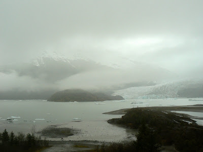
The Mendenhall Glacier is located 12 miles from downtown Juneau. It can be viewed from the Visitor's Center.


The mist and rain played with our visibility

Large chunks of glacier ice floated in the lake formed by the calving of the glacier.
 You can see a time lapse depiction of the advancement and recession of the glacier on the website provided below.


Lou is enjoying viewing the glacier from the warmth of the Visitors Center.
This is as close as we will ever get to climbing a glacier!


Monday, May 12, 2008

Continuing Our Voyage In Alaska - Click on the icons in this interactive map to see details.


View Larger Map

Auke Bay Harbor

We are docked at Auke Bay Harbor which is 12 miles north of downtown Juneau. Auke Bay is quiet and has all the amenities close by. There is hourly bus service for $1.50 to Juneau and the Airport.
We were concerned about the Douglas Bridge in central Juneau because of the height of our
65 ft.mast. We chose to go on the west side of Douglas Island to Auke Bay instead of Gastineau Channel to Juneau. There is one harbor across the channel from Juneau on the south side of the bridge with limited space called Douglas Harbor. We were also told that it is very noisy with float plane activity.
Daniel and Melanie return to Santa Cruz on May 11th. We have had a wonderful adventure and they will greatly missed.

May 8th Juneau (docked at Auke Bay Harbor)

Here we are in downtown Juneau. It is full of bars, restaurants, souvenir shops and jewelry stores. It is very clean and well kept. Many cruise ships stop here so the population swells upon arrival of a ship and then disappears at meal times aboard or when the ship pulls out. Juneau is the capitol city of Alaska and is accessible only by water. There are no highways leading to it. This means everything has been brought here by ship or barge! It is a bustling city with many cars and trucks. Simply amazing!
 Even though there are many jewelry stores in Juneau with lots of big diamonds I personally prefer "Glacier Ice" These three gems were broken off an iceberg from the Sawyer Glacier in Tracy Arm by Daniel and Melanie.
We took the Mt. Roberts Tramway up the mountain and saw incredible views. The tram is run by the Tlingit Tribe and has a tribal history center as well as a bar, restaurant, nature center and gift shop

Looking southeast.


Looking northwest at sunset.

What a view!


This is Russian fast food. This little cafe on the waterfront is open until 3 am and they only serve "Russian Raviolis" You just walk up and say:"I will have one order." They are really delicious!

May 7th The Glory of Tracy Arm and Sawyer Glacier!

In the morning we awake to a magnificent blue sky. We pull anchor and begin our journey into the indescribable beauty of the enchanted inlet.
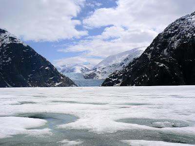
Icebergs begin to appear. Their form changes as if to struggle to stay whole.The densely compacted blue ice reflects in the smooth freezing water.


. We imagine them to be all sorts of figures of birds, fish, frogs and mythical creatures.

The perfect reflection plays with our visual senses as we proceed back in time.
As we continue up the inlet we are struck speechless by the pristine beauty.Owens Peak looms in the distance elevation 8,100 feet. 

At last we see the head of the Sawyer Glacier an ice river frozen in time. A frozen field of fresh water from the glacier is cradled by the deep rock crevasse worn away by its icy ruffled edges.

Huge chucks of blue ice escape by the calving of the glacier

We motor as close as we can to the ice sheet.  It is thrilling beyond our imaginations to witness this spectacular sight avoiding icebergs since 75 per cent of the mass is underwater.

Calving forces icebergs to break off.


We must head back to anchorage and find our way through the maze of icebergs with plenty of light to navigate.
WE ARE RENDERED SPEECHLESS FROM OUR EXPERIENCE!