 |
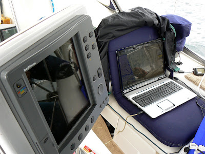
| We immediately brought up our laptop to the cockpit which has Nobletech installed and is our backup electronic navigation system. In the photo you can see our Raytheon Chart Plotter is blank. |
 |
| The instruments are also blank which read depth, speed over ground, wind direction and wind speed. |
 |
| We rely on the laptop and our back up depth meter to navigate the narrows. |
 |
| Current speeds can reach 12 knots. You can see by the growth on buoy #8 when the current is running it is on its side. |
 |
| Add caption |
 |
| This high speed ferry caught us by surprise! |

1 comment:
Wow, Mary and Lou! Our hats are off to you, two, managing to navigate through truly "perilous straights" with minimal electronics! Best regards, Sharon & Dick, s/v Last Resort
Post a Comment