Friday, September 16, 2005
A DAY TRIP TO QUADRA ISLAND SEPT. 16TH
A short ferry ride across Discovery Passage and we arrived on Quadra Island. Our destination was the Tsa Kwa Luten Lodge. We called a taxi and to our surprise the woman driving offered to give us a guided tour of the Cape Mudge First Nation's Village. She showed us the tribe's canoe which was carved in the village from a single cedar tree. We saw the school and community center. She told us how the early natives of Quadra would charge a toll to explorers and trade ships to guide them through the infamous Seymour Narrows. Having the local knowledge of the tides allowed them to pass safely. One can only imagine what the early explorers endured without this guidance. We arrived at the lodge and on the front door we were greeted with a sign: "BEWARE! BEAR SIGHTING IN AREA". We had a delicious lunch and then hiked to the Cape Mudge Lighthouse. Supposedly, there are over 50 petroglyphs carved on the boulders near the low tide line. We searched but did not find any among the infinite number of boulders on the beach. We returned to the lodge and bummed a ride from one of the employees back to the ferry. It was another wonderful day in paradise.
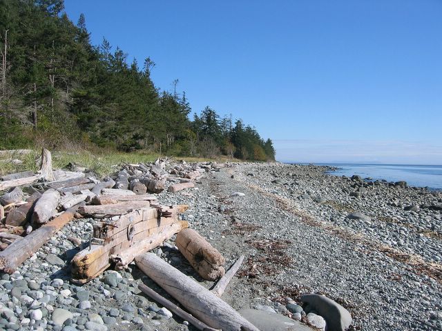
On the beach along Discovery Passage on Quadra Island we found the "Bones" of old boats. Over the centuries hundreds of boats have sunk in these turbulant waters.
Posted by Picasa

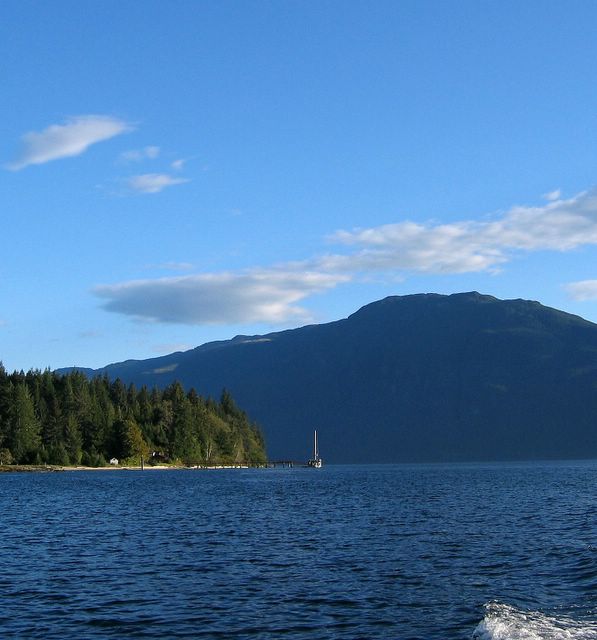
We hiked to the Cape Mudge Lighthouse. The is one of the sites where Captain Vancouver landed and made contact with the First Nations Tribes in the 1700's.
Posted by Picasa
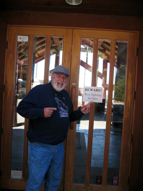
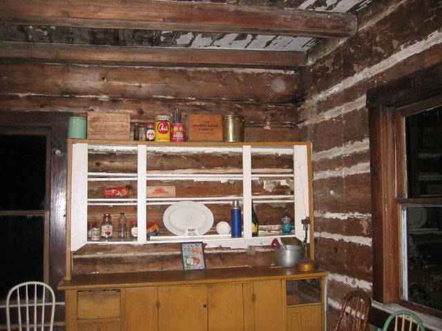
Louie reacting to the warning sign on the door of the First Nation's "Tsa Kwa Luten Lodge".
Posted by Picasa

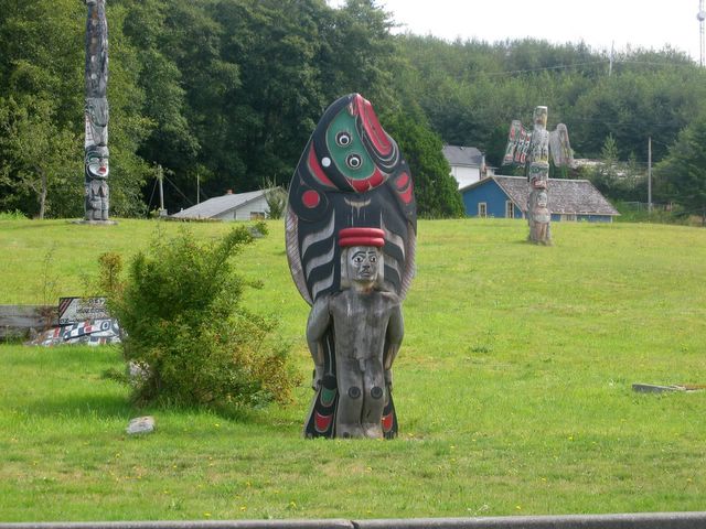
A Totem Pole in the process of being carved in the First Nation's Village on Quadra Island.
Posted by Picasa

This is a canoe carved from a single cedar log.Hot Rocks are placed inside the carved out log then steam seals and shapes it. It has been rowed from Quadra Island to the Queen Charlottes.
Posted by Picasa
BLIND CHANNEL THROUGH THE INFAMOUS SEYMOUR NARROWS SEPT. 14TH
We rode the tide from Port Neville to Blind Channel sometimes reaching over 10 knots.
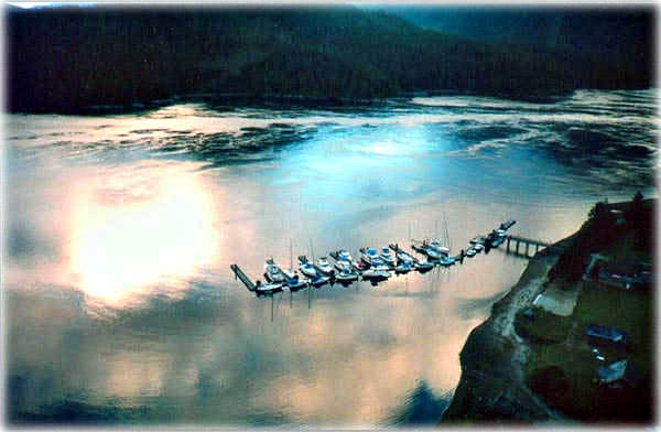
Blind Channel Marina is one of our favorites. We arrived early enough to enjoy the afternoon on the patio overlooking the channel talking with the owner and staff.
The next day we departed at 10:30 AM carefully calculating our passage through the infamous Seymour Narrows. We mis-calculated 2 years ago and went through at MAX tide which was one of the most terrifying experiences of our lives. We were being pushed through at speeds of over 18 knots and being thrown around by the treacherous whirlpools. Captain George Vancouver described in the late 1700s as "one of the vilest stretches of water in the world." It earned a reputation as the fiercest, and arguably, the most dangerous area for nautical navigation in North America.
Ripple Rock resided in the middle of the narrows and had pierced the hulls and sank over 120 vessels and took at least 114 lives. In 1958 it was decided to explode the obstruction. It was the largest non-nuclear explosion ever. The blast pulverized 370,000 tons of rock and displaced 320,000 tons of water. Rock and debris rocketed 1,000 feet into the air. The explosion also created a 25-foot tidal wave which quickly dissipated and caused no damage.
We made it through safely at slack tide and docked at Discovery marina in Campbell River.


Entering Johnstone Strait from Mayne Channel after spending the night at Blind Channel Marina. The fog is lifting revealing the mountainous shoreline.
Posted by Picasa

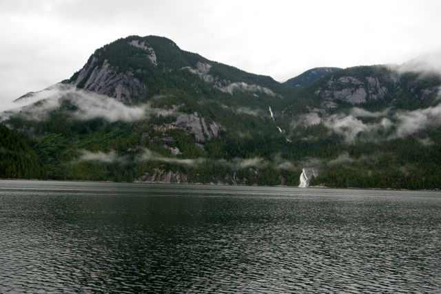
This is the infamouse Seymour Narrows at slack tide. The extire length of Vancouver Island's portion of the Inside Passage narrows and flows through this point.
Posted by Picasa

Wednesday, September 14, 2005

PORT NEVILLE SEPTEMBER 11TH AND 12TH
We motored down Johnstone Strait for about 6 hours and welcomed the sight of Port Neville. We tied up at the dock and immediately got into the dinghy to hunt for the petroglyphs and pictographs that we had heard of. We met two very nice men that offered to show us the locations. We first saw the petroglyphs at Robber's Knob about mid way down the inlet. Since it was getting dark we made arrangements to meet our new friends the next day to find other locations. We returned to the boat and had Seafood Fettucine with our crab, prawns and clams. The next day we met and followed Rusty and Marv to the sites. We enjoyed their company so much we invited them to dinner on the boat. On the way back to Port Neville dock we picked up some kelp that clogged the cooling water intake on our outboard motor. The motor overheated, stalled several times and eventually died. Hopefully, we will have it repaired in Campbell River.
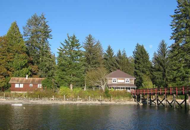
This is Port Neville and the Hansen family and descendants have lived here for over 100 years. The building in front of the government dock was built in 1895. It is in the process of being restored to its original state using the family's heirlooms. Lorna Hansen Chesluk, the daughter, is now the postmaster as her father was in the past. There are no roads so mail is delivered once weekly by floatplane. She lives alone since her daughter has recently gone to Campbell River to attend High School. It is truly an isolated life with the exception of the boats that pull in to avoid heavy weather conditions on Johnstone strait.
Posted by Picasa
Seventh Heaven is tied up at Port Neville dock while we go hunting for Petroglyphs and Pictographs at the head of the inlet.
Posted by Picasa
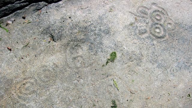
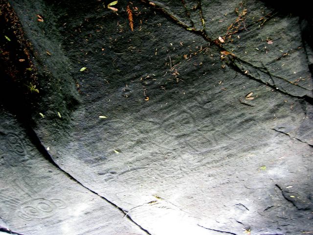
We locate petroglyphs of faces that seem to float in the stone at Robber's Knob midway down the inlet.
Posted by Picasa

This is one of the more defined carvings of a deer. It is located on the rocks at Robber's Knob.
Posted by Picasa

We followed our new friends Rusty and Marv to Collingwood Point to locate petroglyphs and pictographs.
Posted by Picasa
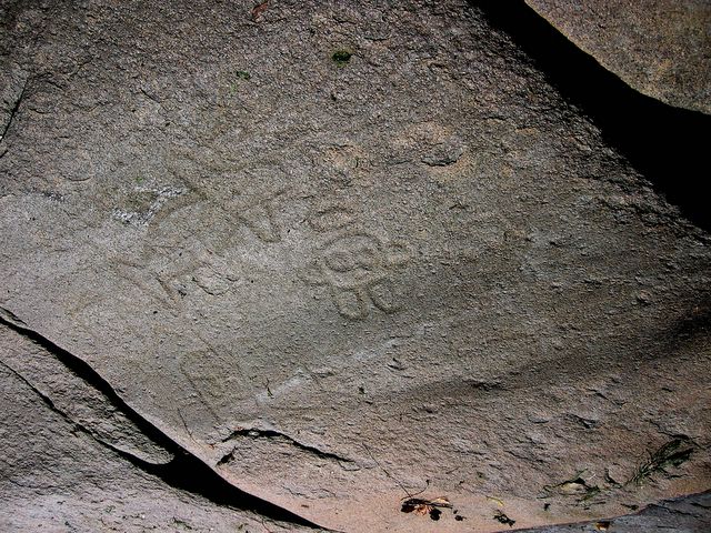
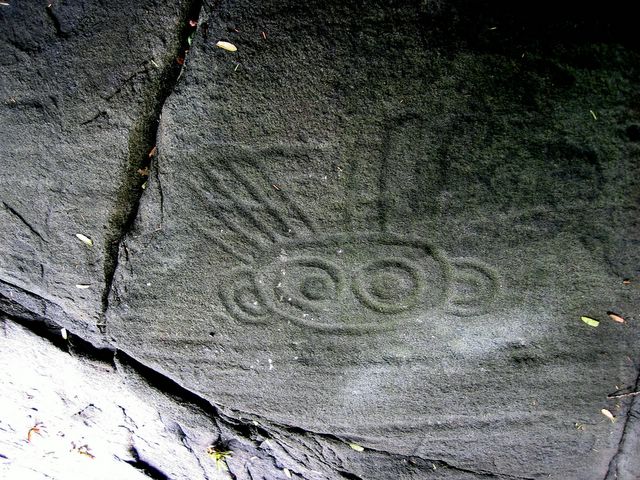
We landed the dinghys on the shore and climbed the rocks to the location of several petroglyphs hidden under branches of trees. This was very faint however, it appears to represents a man who is holding his hands up.
Posted by Picasa

Tuesday, September 13, 2005
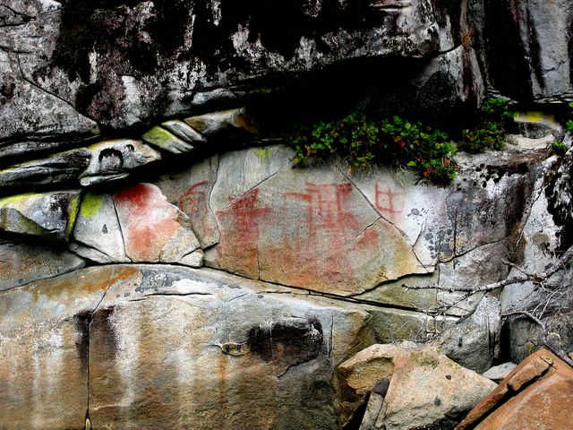
With the help of our new friends we found the pictographs just beyond the narrows near Collingwood Point
Posted by Picasa
WE BEGIN OUR VOYAGE SOUTH TOWARDS FRIDAY HARBOR, WA ON SEPTEMBER 10TH
After our family left we completed our maintenace and provisioning. We had our 25 hp outboard motor mounted back on the dinghy and completed our final preparations for the our voyage south to Friday Harbor and Sidney. A day before we were to leave the weather changed and it blew 25 to 40 knots all day and all night for 3 days. Finally on September 10th our weather window opened up to a spectacular cloudless, sunny, warm day. We departed Port McNeill at 11 AM to ride the tide to our destination of Port Neville. Along Johnstone Strait near Robson Bight we saw a pod of Orcas near the shoreline. I hurried to the bow with camera in hand and photographed a beautiful female breaking away from her pod and swimming towards us and then under our boat. I was so excited I knocked my sunglasses off my head and they fell into the water. We watched her until she rejoined her pod and they swam out of sight. We continued toward our destination breathing in the wonderful weather and scenery. We arrived at Port Neville at about 5 PM.
It was an absolutely beautiful day as we left Port Mc Neill and headed south down Johnstone Strait.
Posted by Picasa

We spotted a pod of Orcas rubbing their bodies on the smooth stones of Robson Bight as we were sailing south on Johnstone Strait.
Posted by Picasa


Wednesday, September 07, 2005

"SEVENTH HEAVEN" Catalina 470 Hull # 07 Beam 14 ft. Draft 8 ft. Yanmar 75 HP Turbo Charged Engine
Posted by Picasa
Tuesday, September 06, 2005
CRUISING THE BROUGHTON ARCHIPELAGO LATTITUDE: 50 AUGUST 18TH TO SEPTEMBER 5TH
Our son and daughter joined us in Port McNeill on Aug. 18th to celebrate Dante's birthday and explore the Broughton Archipelago. We crossed Queen Charlotte Strait and entered the Broughtons through Wells Passage to Sullivan Bay. We celebrated Dante's 41st Birthday with a home cooked feast of all of his favorites.
We continued up Grappler Sound through Kenneth Pass to the solitude of Turnbill Cove.
Our travels took us through Sutlej Channel past Kingcome Inlet to Shawl Bay. We visited Echo Bay and enjoyed a wonderful pig roast at Pierre's Marina. Our visit would not have been complete without a visit to Billy Proctor's museum. We took the dinghy to the head of Viner Sound where we viewed and photographed a black bear on the shoreline digging for shellfish. We continued on to Johnstone Strait to view the rubbing beaches of Robson Bight. Dante and Deborah delighted in the viewing of Orcas, Humpbacks, dolphins, porpoise, seals and a myriad of sea birds and eagles. Dante's powerful camera lenses captured the antics of the wonderful creatures. We experienced indescribable natural beauty of the marine landscape. Our weather was varied which added incredible skies full of bellowing clouds with an occasional rainbow. We explored the old First Nations Villages and photographed ancient pictographs on the steep walls of the inlets. We explored Bond Sound in search of Grizzly Bears but was too early for the salmon runs of the Ahta River. We visited Kwatsi Bay one of our favorite places on Earth. Dante navigated the narrow entrance to Booker Lagoon while Louie stood watch on the bow searching for shallows and rocks in the pouring rain. We enjoyed the solitude of anchoring in wonderful coves and bays. We also enjoyed socializing at the friendly marinas "Happy Hours". We met many interesting and fun people. We dined on freshly caught crab and prawns. We enjoyed fresh baked bread,croissants and homemade gourmet pizza. On cold days we indulged in my "Chicken Soup" made from scratch. We had a variety of pastas such as brijole with fettucine, seafood linquini, ravioli with chicken sauce. We devoured fresh green beans with prosciutto and fresh broccoli with garlic and almonds. There were no limits to the enjoyment of our adventure!

We spent the rest of the afternoon at the U'Mista Cultural Center of the Kwakwaka'wakw Tribe.
Posted by Picasa


This memorial pole is of a prominent woman of the Eagle sector of the Kwakwaka'wakw Tribe.
Posted by Picasa
We visit the First Nations cemetary. This grave is marked with a memorial pole of a fisherman.
Posted by Picasa

We catch the ferry in Sointula and must disembark at Port McNeill then turn around and re-board for our trip to Alert Bay
Posted by Picasa


The Pacific Star is our dock neighbor in Sointula. Many boats returned to the marina since the Department of Fisheries closed the salmon season for the year.
Posted by Picasa

A young Bald Eagle hunts for food on the beach at Sointula. A Bald Eagle does not grow the white head and tail feathers until they are 4 years old.
Posted by Picasa

Sept.2nd, we encounter an Alaskan cruise ship on Queen Charlotte Strait on our way back to Sointula.
Posted by Picasa

Fresh water flows into the salt water lagoon stained with the oil of cedar from the forest floor. This is a common phenomenon in this region. The yellowed stained bows of boats is a tell tale sign that your boat has been in northern waters.
Posted by Picasa

By afternoon the weather clears and we go ashore to explore an ancient First Nations Village near our anchorage. We see Seventh Heaven through the trees.
Posted by Picasa


Dante navigates the narrow entrance of Booker Lagoon at slack tide in the rain. We pass the "Stone Man" marker at the entrance.
Posted by Picasa

Sept. 1st, we are underway to Booker Lagoon. The weather cycles with fog, clouds rain and sunshine all within hours during a day. The Canadians have a saying: "If you don't like the weather, wait 10 minutes!"
Posted by Picasa

There are many water falls in the stone amphetheater shaped bay swollen with the runoff of the rain.
Posted by Picasa
Subscribe to:
Posts (Atom)